


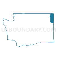
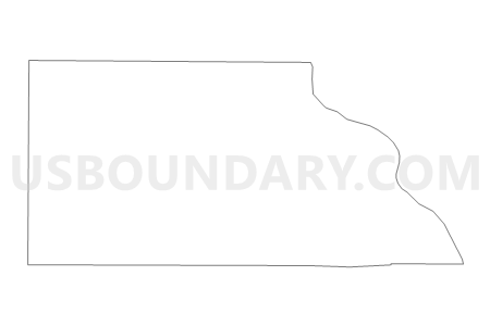
Ruby Voting District, Pend Oreille County, Washington
About
Outline

Summary
| Unique Area Identifier | 687882 |
| Name | Ruby Voting District |
| County | Pend Oreille County |
| State | Washington |
| Area (square miles) | 44.89 |
| Land Area (square miles) | 44.32 |
| Water Area (square miles) | 0.56 |
| % of Land Area | 98.74 |
| % of Water Area | 1.26 |
| Latitude of the Internal Point | 48.52369620 |
| Longtitude of the Internal Point | -117.42086790 |
Maps


Graphs
Select a template below for downloading or customizing gragh for Ruby Voting District, Pend Oreille County, Washington


Neighbors
Neighoring Voting District (by Name) Neighboring Voting District on the Map
- Kalispel - LeClerc Voting District, Pend Oreille County, WA
- Locke Voting District, Pend Oreille County, WA
- Narcisse Voting District, Stevens County, WA
- Tiger - Dry Canyon Voting District, Pend Oreille County, WA
Top 10 Neighboring County Subdivision (by Population) Neighboring County Subdivision on the Map
- Colville CCD, Stevens County, WA (11,113)
- Newport CCD, Pend Oreille County, WA (10,902)
- Ione-Metaline Falls CCD, Pend Oreille County, WA (2,099)
Top 10 Neighboring Unified School District (by Population) Neighboring Unified School District on the Map
- Colville School District, WA (11,571)
- Selkirk School District, WA (2,213)
- Cusick School District, WA (1,989)
Top 10 Neighboring State Legislative District Lower Chamber (by Population) Neighboring State Legislative District Lower Chamber on the Map
Top 10 Neighboring State Legislative District Upper Chamber (by Population) Neighboring State Legislative District Upper Chamber on the Map
Top 10 Neighboring 111th Congressional District (by Population) Neighboring 111th Congressional District on the Map
Top 10 Neighboring Census Tract (by Population) Neighboring Census Tract on the Map
- Census Tract 9702, Pend Oreille County, WA (2,649)
- Census Tract 9506, Stevens County, WA (2,265)
- Census Tract 9701, Pend Oreille County, WA (2,099)